Are all the geoprocessing tools from ArcMap in ArcGIS Pro?
The majority of geoprocessing tools that are available in ArcMap are also available and working in ArcGIS Pro. Some tools have not yet been updated to work in ArcGIS Pro, but they will be available in a future release. Other tools process a dataset that is not supported in ArcGIS Pro, so they have been permanently removed. You can get more details here.
ArcGIS Pro继承了ArcMap大部分的GP工具,但是还有一部分工具没有同步到ArcGIS Pro,在未来的版本中也会考虑同步过来,但是ArcGIS Pro也不会对所有ArcMap的GP工具进行支持,有些工具可能就不会支持,具体工具的相关信息,可以点击英文的here来查看!

Explore the list of all geoprocessing tools in the Geoprocessing pane
Are there new tools in ArcGIS Pro?
Yeah! There are some great new tools in Pro, including:(ArcGIS Pro增加了ArcMap所没有的GP工具:)
- Space-Time Pattern Mining tools
- Enrich Layer, for performing geoenrichment (uses ArcGIS Online service credits)
- Tools to classify LAS dataset points by their height from ground, and calculate statistics about LAS dataset points within polygons
- Block adjustment tools to fine-tune the georeferencing of raster mosaics
- Imagery segmentation and classification tools
- And many more
Most of these new tools are also available in ArcMap 10.3, or will be added in a future release of ArcMap.
ArcMap的用户不用担心,这些工具也会考虑添加到ArcMap中。
ArcGIS Pro is a 64-bit, multithreaded application. Does ArcMap 10.3 now also support 64-bit, multithreaded geoprocessing?
ArcMap and ArcGIS Pro are built on different technologies. Off the shelf (my.esri.com is a shelf, right?), geoprocessing in ArcGIS Pro is 64-bit and does not block the application while a tool is running — this is what it means to be multithreaded. ArcMap has a different technology to accomplish the same goal, called background geoprocessing, which was introduced in ArcGIS Desktop 10.0. You can download and install a 64-bit version of this technology, separate from the main installation of ArcMap. Learn more about that here.
ArcMap和ArcGIS Pro 使用了不同技术。ArcGIS Pro的GP是64位的应用程序,当工具运行过程中是不会停止,这就称之为多线程GP。ArcMap使用了不同的技术但是完成的目的是一样的,我们称之为后台GP,这个后台GP从ArcGIS10就已经应用起来了。ArcMap用户可以下载64位的后台GP应用程序。
Are geoprocessing tools faster in ArcGIS Pro?
Geoprocessing performance is roughly equivalent between ArcGIS Pro and ArcMap. 64-bit geoprocessing does not make tools faster only able to load more data into memory. 64-bit geoprocessing is more robust, results will be more accurate, and processes that used to hang or run out of memory may be able to complete successfully. Likewise, a multithreaded app does not make geoprocessing faster. More details on that below.
ArcGIS Pro和ArcMap的GP性能大致相当的。64位GP不是指该工具执行的够快,而是指该工具可以充分利用内存资源。64位GP工具更加的稳定,结果更加的精确,执行过程不会因为消耗内存过大而hang,所以成功率更加可以得到保证。所以,多线程的APP并不是代码GP运行就更快。
Tell me more about geoprocessing and multithreading
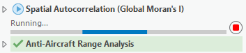
When you run a geoprocessing tool in ArcGIS Pro, it runs on a thread dedicated to geoprocessing. This means that when a tool is running you can do other things in the app, such as add new data to a map, navigate and make selections in the map, change a layer’s symbology or labels, create and modify a layout, and even find and fill in another geoprocessing tool. If you run a geoprocessing tool while another tool is running, it gets added to a queue and will start running after the first one finishes.
当你在ArcGIS Pro应用程序执行一个GP工具时,会有一个专属的进程为该GP运行服务,这就意味着这你可以在运行该GP工具的同时,去干其他事情,例如添加一个新数据,浏览和选择地图数据,改变图层的标注和符号,创建或者修改图框,甚至去执行另一个GP工具。如果你在一个GP工具执行过程中,又执行了另一个GP工具,那么系统会排好队列,在第一个GP结束之后开始运行另一个GP。
This behavior is the same for all geoprocessing tools run inside Pro: the tools that are included in ArcGIS, and the custom tools you build in Python and ModelBuilder.
One additional note: multithreaded is not the same thing as parallel processing! Parallel processing is a technique which splits up a big job into many smaller jobs and allows multiple CPUs or processes to work on the big job at the same time, often resulting in faster processing time. A growing number of geoprocessing tools leverage parallel processing to improve performance. In the first release of Pro, there are 25 tools that support parallel processing, including a number of geostatistics tools and Spatial Analyst tools.
注意:多线程并不等同于并行处理。并行处理可以将一个大的job细分为许多小的jobs,允许多个CPU或者进程同时对这个大job进行处理,这样无疑可以提高执行效率。越来越多的地理处理工具利用并行处理,以提高性能。在ArcGIS Pro1.0版本,有 25 个工具支持并行处理,包括大量的地质统计学工具和空间分析工具的工具。
Are there license level or extension changes for geoprocessing tools in Pro?
No. ArcGIS Pro has the same licensing levels as other ArcGIS Desktop applications – Basic, Standard, and Advanced. The license level and extension requirements for any geoprocessing tool is the same in ArcMap and ArcGIS Pro. Refer to the tool help page to learn what license and extension is required.
没有,ArcGIS Pro和ArcGIS Desktop是一致的,包括基础版、标准版、高级版。ArcMap和ArcGIS Pro在许可级别、扩展方面都是一致的。
Does ArcGIS Pro have ModelBuilder?
Yes, you can build geoprocessing models in a ModelBuilder view, and run those models in the same ways you do in ArcMap. You can learn about ModelBuilder in ArcGIS Pro here and get migration tips here.
是的,用户可以在ArcGIS Pro来创建Model Builder,就像你们在ARCMap的操作方式一样。
Will models built in previous versions of ArcMap work in ArcGIS Pro?
Yes, most of the time. There are a few exceptions:
是的,大部分ARCMap早期版本生成的Models都可以运行在ArcGIS Pro中,但是还是有些需要注意:
- If a tool in the model is not yet available in Pro, then the model will not work. You may need to wait until that tool is available in a future release of Pro, or you can remove the tool and try to find a workaround.
- 如果ArcGIS Pro的模型工具不可用,这回导致整个模型不能工作。你可能需要使用更新的ArcGIS Pro版本才支持该工具,或者移除该工具来解决。
- If a tool in the model has changed in Pro, then the model will not work until you update the model (simply open the model in Pro, validate, and save). Refer to a tool’s help page to determine what needs to be changed for the tool to work in Pro. One common issue is the Calculate Field tool has changed to support only Python expressions. Learn more about that specific change here.
- 如果ArcGIS Pro的模型工具已经更改,整个模型只有更新才能给工作。更新过程比如在ArcGIS Pro中打开,验证和保存)、这里面需要用户查询Pro的工具帮助,看看哪些工具需要这样操作。不过还有些工具比较特殊,比如字段计算器,该工具的改变只支持Python脚本。
Caution! Models that are built new, or opened and saved in ArcGIS Pro, cannot be directly used in ArcMap. But you can always save the containing toolbox as a previous version (10.3, 10.2, etc.) and then use that toolbox back in ArcMap. It’s safest to make a copy of the original toolbox before modifying any models in Pro.
注意:ArcGIS Pro创建的、打开的、保存的模型是不能直接在ArcMap中使用的,但是你可以将包含工具箱保存为早期版本(10.3、10.2等),这样ArcMap就可以打开了。
What is the difference between Tasks and ModelBuilder?
Tasks and ModelBuilder are conceptually similar, but have different goals and capabilities.
任务和模型构建器概念有点相似,但是他们的目标和功能还是有所不同的。
Tasks are a set of preconfigured steps through a process or workflow in ArcGIS Pro. Task steps can include any GIS tasks, such as zooming to a specific feature, editing a layer, running geoprocessing tools, authoring a map, and sharing it online.
任务是一组通过流程或工作流在 ArcGIS Pro 的预配置步骤。任务步骤可以包括任何地理信息系统的任务,例如缩放到一个特定的功能,编辑图层,运行地理处理工具、 创作一张地图,和在线共享。
ModelBuilder on the other hand is specifically designed to author and automate geoprocessing workflows. It includes features to support powerful operations like batch processing and simulation, and can be used to create a custom geoprocessing tool that can be used by others with different data.
模型构建器被专门创作和自动化地理处理工作流。它包括功能以支持强大的操作 (如批量处理和模拟,并可用于创建自定义地理处理工具,它可以由其他人用不同的数据。
Tasks are not a replacement for ModelBuilder, and ModelBuilder tools can even be included as one step in a Task.
Will Python scripts and toolboxes written for ArcGIS 10.x (using Python 2.x) work in ArcGIS Pro?
Usually, yes. ArcGIS Pro uses Python 3.4, while the other apps in ArcGIS Desktop & Server 10.3 use Python 2.x. Despite some significant differences between these versions of Python, many geoprocessing scripts can be used as-is in both ArcMap and ArcGIS Pro. In my experience there are a few common issues that will require you to update your scripts:
通常情况下,是的。ArcGIS Pro 使用 Python 3.4 而 ArcGIS 桌面 & 服务器 10.3 的其他应用程序使用的 Python 2.x。尽管一些 Python 这些版本之间的重大差异,许多地理处理脚本可以用作-在 ArcMap 和 ArcGIS Pro。以我的经验有几个常见的问题,将要求您更新您的脚本:
Some geoprocessing tools have been removed from ArcGIS Pro. If your script includes one of these tools you will either need to find a workaround or simply wait until the tool or a replacement has been added to Pro.
一些地理处理工具在ArcGIS Pro中已被删除。如果您的脚本中包含这些工具之一你将需要找到一种解决方法,或只是等待ArcGIS Pro的更新版本有该工具的替代工具。
The arcpy.mapping module has been removed in Pro, and replaced with the new arcpy.mp module for working with maps in Pro’s new project-based design.
Arcpy.mapping 模块在ArcGIS Pro中已经被移除了,不过使用新的 arcpy.mp 模块来代替该供,用于与地图的 Pro 的新的基于项目的设计工作。
Print statements will need to be changed to use the new print function.
Print 语句将需要将更改为使用新的打印功能。
Working with Python dictionary items is a little different
用 Python 字典项工作是有点不同
Use of urllib2 in Python 2 will need to be changed to use the new urllib library in Python 3.
Toolbox with many Python script tools, all of which were written in ArcMap 10.1 and work without any modification in Pro.
There are other things you will need to update, these are just some common things I have run into. Read this help topic for more details.
To help you on the way of migrating Python scripts from 2 to 3, ArcGIS Pro and ArcMap 10.3 both have a new geoprocessing tool for analyzing a Python script file or toolbox and giving line-by-line instructions on required changes.
Are both personal and file geodatabases available as data sources for ArcGIS Pro?
Personal geodatabases are not supported in ArcGIS Pro, so you cannot use personal geodatabase datasets as inputs to geoprocessing tools or create those datasets as outputs.
File geodatabases are fully supported and are the default workspaces for ArcGIS Pro projects.
ArcGIS Pro将不再支持个人地理数据库,所以你在执行GP工具时既不能将PGDB添加为输入项,也不能添加为输出项
ArcGIS Pro建议你使用文件地理数据库来完成该操作。
Do analysis services and new tools like Enrich Layer use ArcGIS Online service credits?
Yes. In ArcGIS Pro you can connect to and use several ready-to-use analysis services, including:
是的,ArcGIS Pro可以连接现有的分析服务:
- http://hydro.arcgis.com/arcgis/services
- http://elevation.arcgis.com/arcgis/services
- http://logistics.arcgis.com/arcgis/services
These services make it incredibly easy to perform analysis without needing to hunt for or prepare data, read documentation, or follow best-practices. For example, you can get street network routing without needing your own Network Analyst dataset, or perform a Viewshed analysis without needing to download and prepare a DEM for your study area. These services consume credits.
这些服务可以让用户无需准备繁杂的数据就可以获得相应的服务功能,用户只需要阅读以下相关的文档即可,例如,您可以获取街道网络路由而不需要您自己创建网络数据集,或无需下载数据就可以对DEM执行视域分析。不过这些服务都需要消耗配额的。(简单的说,是需要花钱的)

ArcGIS Pro also includes a new geoprocessing tool, Enrich Layer, which enables you to add demographic, landscape, and community tapestry information to your GIS data. For example, you can add a population field to a school district layer, and the population will be correctly apportioned from overlapping census data to calculate a sum. This tool consumes credits.
ArcGIS Pro 还包括新的地理处理工具、例如Enrich Layer,该工具使您能够添加人口,景观和社区信息到您的地理信息系统数据。例如,您可以添加人口领域到学区的图层,并且人口将正确分配从重叠的人口统计数据。此工具消耗配额。
Can I publish a geoprocessing service?
The first release of ArcGIS Pro does not allow you to publish geoprocessing services. In fact, you cannot publishany services to an ArcGIS server, as you can only make user connections to these servers. Publishing functionality will be added at a later release.
ArcGIS Pro 1.0还不支持用户发布GP服务,事实上,你不能到 ArcGIS Server发布所有服务,你只可以使用户连接到这些服务器。在今后的版本,将添加发布功能。
Is the 3D Analyst extension required for ArcGIS Pro to work with 3D maps and layouts?
The 3D Analyst extension is only required for performing 3D analysis; if you want to run geoprocessing tools in the 3D Analyst toolbox, you need the 3D Analyst extension. Even if you don’t have this extension you can still navigate, author, edit, and share 3D maps.
只有执行 3D 分析功能才需要有3D分析扩展许可 ;如果你想要运行地理处理工具在 3D 分析工具箱中,你需要 3D 分析扩展许可。即使你没有这个扩展许可,您还可以导航,授权、 编辑和共享 3D 地图。