Friends who are engaged in the GIS industry may have such a demand, that is, the customer gives a pure picture. It may be a manual drawing, or it may be a video image. In short, it is a pure image in png or jpeg format. Now we need to load this image into our map. How should we do it? This article takes you through the operation from 0.
First, I prepare the test data, which is a picture in jpg format:
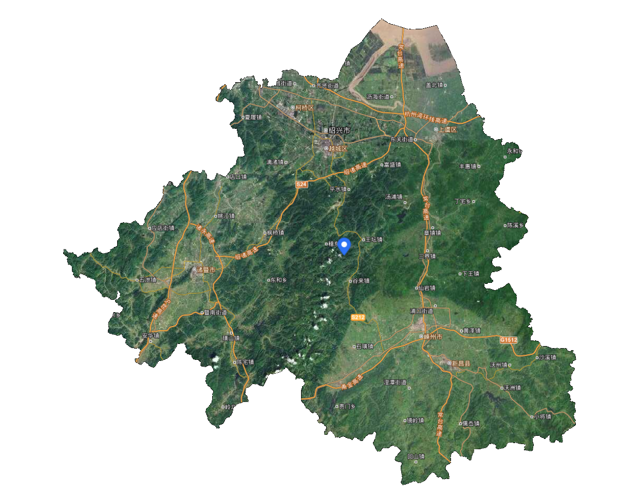
Since a simple picture does not have latitude and longitude coordinate system information, our first step is to determine the latitude and longitude range for this picture. Usually your manual map is usually a certain administrative region or a certain range, so you need to obtain the boundary information by yourself. The boundary range of my test data is: 119.889067, 29.225091, 121.231536, 30.286319
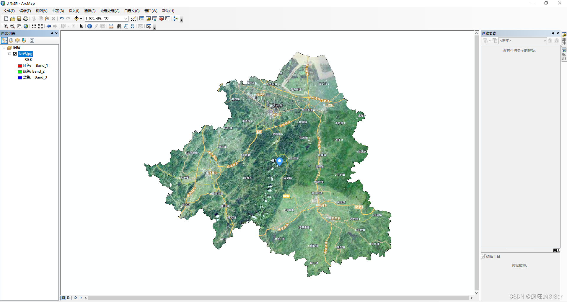
Well, the next step is to convert the picture into a tiff image, because the tiff image carries coordinate boundary information. So we need to use tools such as arcgis or qgis for georeferencing. Here we take arcgis as an example.
Open arcmap and add our data. At first, arcmap will remind us that this data has no reference information, so don’t worry about adding it first.
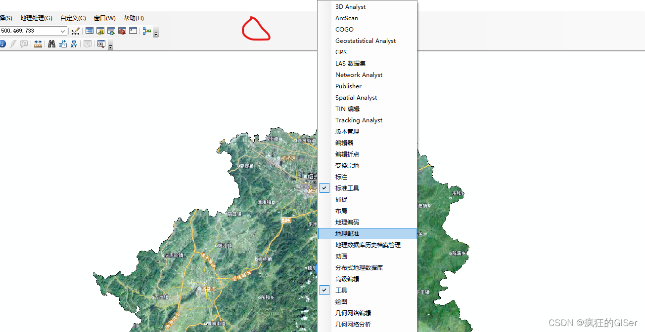
Then right click on the red circle and we directly open the georeferencing.
Click to add control