官网指引,生成accesstoken,下载相关依赖请翻阅[https://blog.csdn.net/weixin_44402694/article/details/125414381?spm=1001.2014.3001.5501](https://blog.csdn.net/weixin_44402694/article/details/125414381?spm=1001.2014.3001.5501)
本文使用官网accesstoken,请自行生成私人token
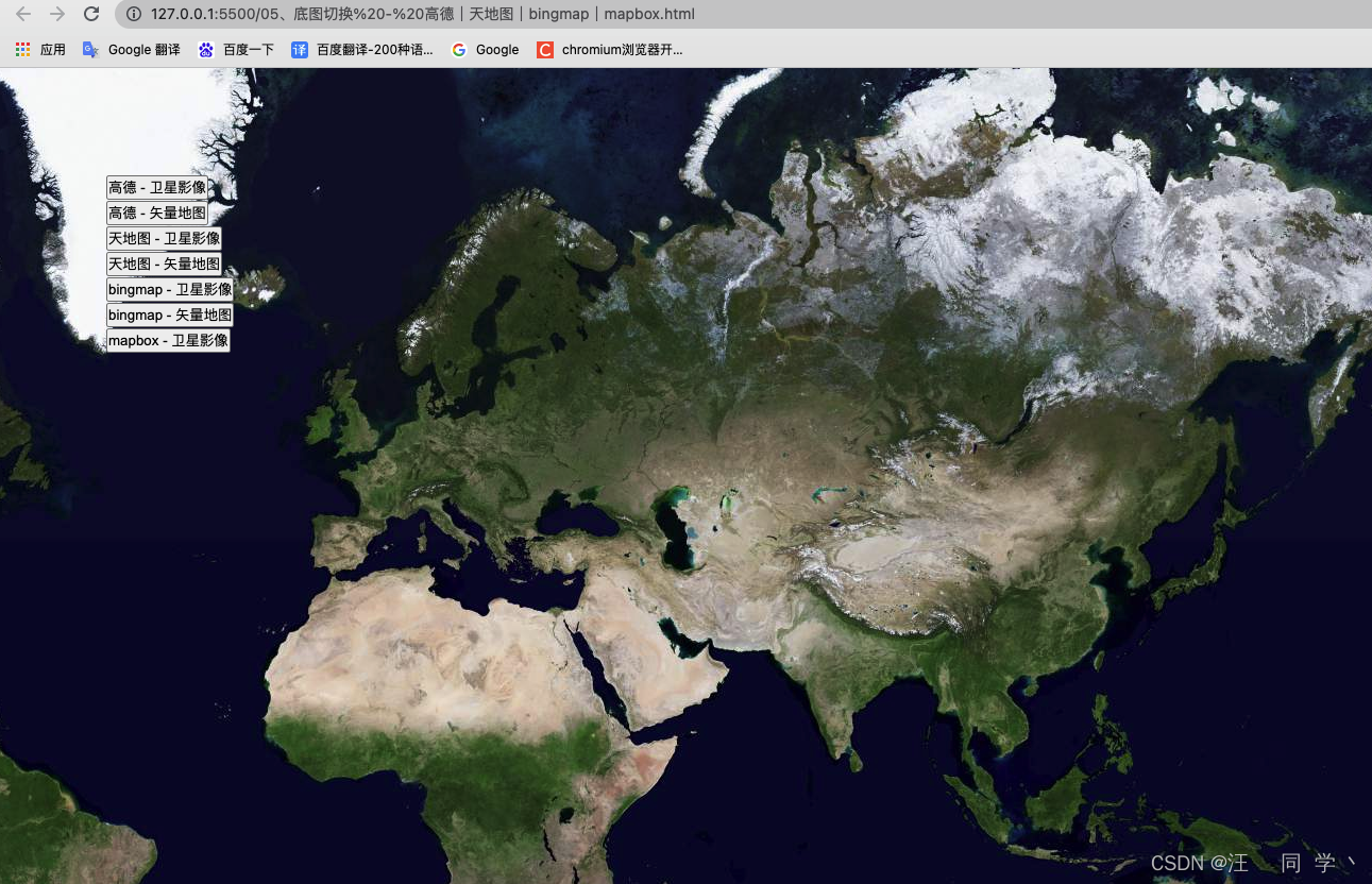
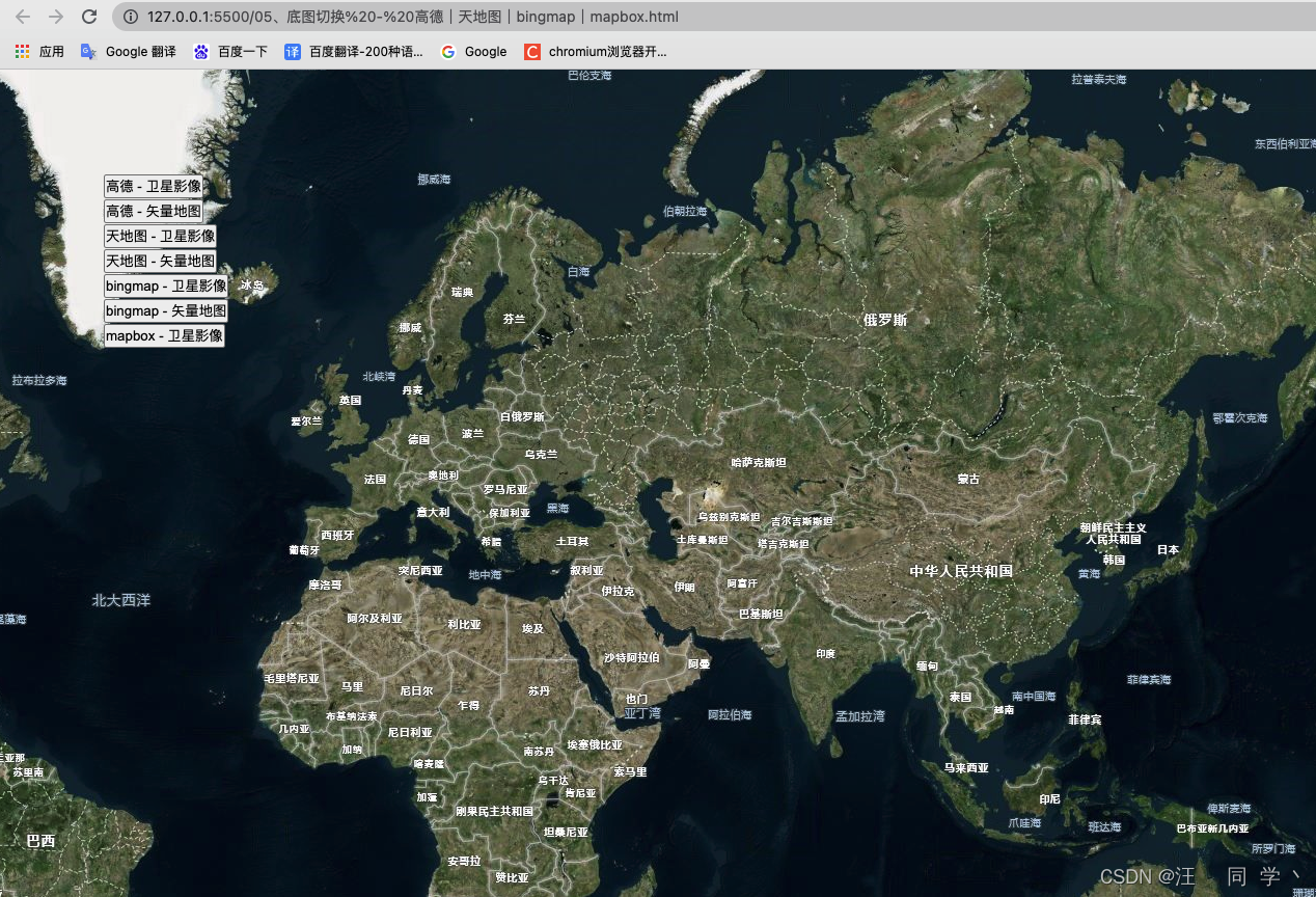
底图切换 - mapbox切换高德、天地图、bingmap等底图
效果
## 代码实现
<!DOCTYPE html>
<html lang="en">
  <head>
    <meta charset="UTF-8" />
    <meta http-equiv="X-UA-Compatible" content="IE=edge" />
    <meta name="viewport" content="width=device-width, initial-scale=1.0" />
    <title>05、底图切换 - 高德|天地图|bingmap|mapbox</title>
    <link
      href="https://api.mapbox.com/mapbox-gl-js/v2.7.0/mapbox-gl.css"
      rel="stylesheet"
    />
    <script src="https://api.mapbox.com/mapbox-gl-js/v2.7.0/mapbox-gl.js"></script>
    <style>
      * {
        padding: 0;
        margin: 0;
        list-style: none;
        text-decoration: none;
      }
      html,
      body {
        width: 100%;
        height: 100%;
      }
      #map {
        width: 100%;
        height: 100%;
      }
      .btn-list {
        position: fixed;
        top: 100px;
        left: 100px;
      }
    </style>
  </head>
  <body>
    <div id="map"></div>
    <ul class="btn-list">
      <li>
        <button onclick="changeMapType('gd-satellite')">高德 - 卫星影像</button>
      </li>
      <li>
        <button onclick="changeMapType('gd-vector')">高德 - 矢量地图</button>
      </li>
      <li>
        <button onclick="changeMapType('tian-satellite')">
          天地图 - 卫星影像
        </button>
      </li>
      <li>
        <button onclick="changeMapType('tian-vector')">
          天地图 - 矢量地图
        </button>
      </li>
      <li>
        <button onclick="changeMapType('bing-satellite')">
          bingmap - 卫星影像
        </button>
      </li>
      <li>
        <button onclick="changeMapType('bing-vector')">
          bingmap - 矢量地图
        </button>
      </li>
      <li>
        <button onclick="changeMapType('mapbox-satellite')">
          mapbox - 卫星影像
        </button>
      </li>
    </ul>
    <script>
      const mapList = [
        { name: '高德地图 卫星影像', layerId: 'gd-satellite' },
        { name: '高德地图 矢量地图', layerId: 'gd-vector' },
        { name: '天地图 卫星影像', layerId: 'tian-satellite' },
        { name: '天地图 矢量地图', layerId: 'tian-vector' },
        { name: 'bingmap 卫星影像', layerId: 'bing-satellite' },
        { name: 'bingmap 矢量地图', layerId: 'bing-vector' },
        { name: 'mapbox 卫星影像', layerId: 'mapbox-satellite' },
      ]
      mapboxgl.accessToken =
        'pk.eyJ1Ijoid2FuZ3Rvbmd4dWUiLCJhIjoiY2pzY3E2M2k0MDk3NzN5dDA0Nmtia2h0cCJ9.oP9fEJxOgVzm0dWGvL6tGg'
      const map = new mapboxgl.Map({
        container: 'map', // 容器 id
        style: {
          version: 8,
          sources: {
            'gd-satellite': {
              type: 'raster',
              tiles: [
                // 高德地图 卫星影像
                'http://wprd04.is.autonavi.com/appmaptile?x={x}&y={y}&z={z}&lang=zh_cn&size=1&scl=1&style=6',
              ],
              tileSize: 256,
            },
            'gd-vector': {
              type: 'raster',
              tiles: [
                // 高德地图 矢量地图
                'http://wprd04.is.autonavi.com/appmaptile?x={x}&y={y}&z={z}&lang=zh_cn&size=1&scl=2&style=7',
              ],
              tileSize: 256,
            },
            'tian-satellite': {
              type: 'raster',
              tiles: [
                // 天地图 卫星影像
                'http://t0.tianditu.gov.cn/img_w/wmts?tk=1883a2da124fe27b3c281f9d65356e82&SERVICE=WMTS&REQUEST=GetTile&VERSION=1.0.0&LAYER=img&STYLE=default&TILEMATRIXSET=w&TILEMATRIX={z}&TILEROW={y}&TILECOL={x}&FORMAT=tiles',
              ],
              tileSize: 256,
            },
            'tian-vector': {
              type: 'raster',
              tiles: [
                // 天地图 矢量地图
                'http://t0.tianditu.gov.cn/vec_w/wmts?tk=1883a2da124fe27b3c281f9d65356e82&SERVICE=WMTS&REQUEST=GetTile&VERSION=1.0.0&LAYER=vec&STYLE=default&TILEMATRIXSET=w&TILEMATRIX={z}&TILEROW={y}&TILECOL={x}&FORMAT=tiles',
              ],
              tileSize: 256,
            },
            'bing-satellite': {
              type: 'raster',
              tiles: [
                // bingmap 卫星影像
                'http://ak.dynamic.t0.tiles.virtualearth.net/comp/ch/{quadkey}?mkt=zh-CN&it=A,G,L&og=819&n=z',
              ],
              tileSize: 256,
            },
            'bing-vector': {
              type: 'raster',
              tiles: [
                // bingmap 矢量地图
                'http://ak.dynamic.t0.tiles.virtualearth.net/comp/ch/{quadkey}?mkt=zh-CN&it=G,L&shading=hill&og=819&n=z',
              ],
              tileSize: 256,
            },
            'mapbox-satellite': {
              type: 'raster',
              tiles: [
                // mapbox 卫星影像
                'https://api.mapbox.com/v4/mapbox.satellite/{z}/{x}/{y}.png?sku=101wZp4uNMRnl&access_token=pk.eyJ1IjoibWFwYm94IiwiYSI6ImNpejY4NDg1bDA1cjYzM280NHJ5NzlvNDMifQ.d6e-nNyBDtmQCVwVNivz7A',
              ],
              tileSize: 256,
            },
          },
          layers: [
            {
              id: 'gd-satellite',
              type: 'raster',
              source: 'gd-satellite',
              layout: {
                visibility: 'visible',
              },
              minzoom: 0,
              maxzoom: 22,
            },
            {
              id: 'gd-vector',
              type: 'raster',
              source: 'gd-vector',
              layout: {
                visibility: 'none',
              },
              minzoom: 0,
              maxzoom: 22,
            },
            {
              id: 'tian-satellite',
              type: 'raster',
              source: 'tian-satellite',
              layout: {
                visibility: 'none',
              },
              minzoom: 0,
              maxzoom: 22,
            },
            {
              id: 'tian-vector',
              type: 'raster',
              source: 'tian-vector',
              layout: {
                visibility: 'none',
              },
              minzoom: 0,
              maxzoom: 22,
            },
            {
              id: 'bing-satellite',
              type: 'raster',
              source: 'bing-satellite',
              layout: {
                visibility: 'none',
              },
              minzoom: 0,
              maxzoom: 22,
            },
            {
              id: 'bing-vector',
              type: 'raster',
              source: 'bing-vector',
              layout: {
                visibility: 'none',
              },
              minzoom: 0,
              maxzoom: 22,
            },
            {
              id: 'mapbox-satellite',
              type: 'raster',
              source: 'mapbox-satellite',
              layout: {
                visibility: 'none',
              },
              minzoom: 0,
              maxzoom: 22,
            },
          ],
        }, // mapbox底图
        center: [108, 35], // 初始化中心点
        zoom: 2, // 初始化层级
      })
      // 底图切换
      function changeMapType(layerId) {
        mapList.forEach((item, index) => {
          const showStatus = item.layerId === layerId ? 'visible' : 'none'
          map.setLayoutProperty(item.layerId, 'visibility', showStatus)
        })
      }

    </script>
  </body>
</html>
原文链接:【MAPBOX基础功能】05、底图切换 - mapbox切换高德、天地图、bingmap等底图_mapbox使用高德地图图层-CSDN博客