1. 前言
本博文介绍的脚本,能够较为方便在指定区域批量地将遥感影像裁剪成固定大小的切片。
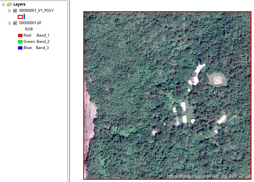
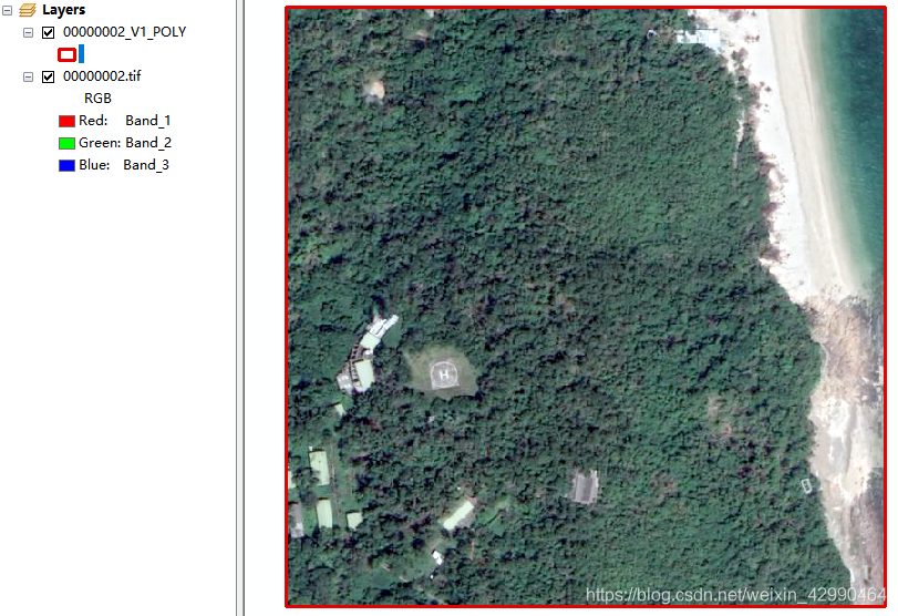
2. 样本准备
影像以及对应的点矢量
3. 基于gdal的裁剪代码
# -*- coding: utf-8 -*-
from osgeo import ogr
import os, sys
import numpy as np
import cv2
import numpy
import gdal
import time
import glob
from osgeo import osr


def del_file(path):
    for i in os.listdir(path):
        path_file = os.path.join(path, i)
        if os.path.isfile(path_file):
            os.remove(path_file)
        else:
            del_file(path_file)


def sampleClip(shp,tif,outputdir,sampletype,size, fieldName='cls', n=None):
    time1 = time.clock()
    # if not os.path.exists(outputdir):
    #     os.mkdir(outputdir)
    # else:
    #     del_file(outputdir)

    gdal.AllRegister()
    lc = gdal.Open(tif)
    im_width = lc.RasterXSize
    im_height = lc.RasterYSize
    im_geotrans = lc.GetGeoTransform()
    bandscount=lc.RasterCount
    im_proj = lc.GetProjection()
    print(im_width,im_height)
    gdal.AllRegister()
    gdal.SetConfigOption("gdal_FILENAME_IS_UTF8","YES")

    driver = ogr.GetDriverByName('ESRI Shapefile')
    dsshp = driver.Open(shp, 0)
    if dsshp is None:
        print('Could not open ' + 'sites.shp')
        sys.exit(1)
    layer = dsshp.GetLayer()
    xValues = []
    yValues = []
    m = layer.GetFeatureCount()
    feature = layer.GetNextFeature()
    print("tif_bands:{0},samples_nums:{1},sample_type:{2},sample_size:{3}*{3}".format(bandscount,m,sampletype,int(size)))

    if n is not None:
        pass
    else:
        n=1
    while feature:
        dirname = "0000000" + str(n)
        #print dirname
        dirpath=os.path.join(outputdir,dirname+"_V1")
        if not os.path.exists(dirpath):
            os.mkdir(dirpath)
        tifname=dirname+".tif"
        if "poly" in sampletype or "POLY" in sampletype:
            shpname=dirname+"_V1_POLY.shp"
        if "line" in sampletype or "LINE" in sampletype:
            shpname=dirname+"_V1_LINE.shp"
        geometry = feature.GetGeometryRef()
        x = geometry.GetX()
        y = geometry.GetY()
        print(x,y)
        print(im_geotrans)
        xValues.append(x)
        yValues.append(y)
        newform=[]
        newform=list(im_geotrans)
        #print newform
        newform[0]=x-im_geotrans[1]*int(size)/2.0
        newform[3]=y-im_geotrans[5]*int(size)/2.0
        print(newform[0],newform[3])
        newformtuple=tuple(newform)
        x1=x-int(size)/2*im_geotrans[1]
        y1=y-int(size)/2*im_geotrans[5]
        x2=x+int(size)/2*im_geotrans[1]
        y2=y-int(size)/2*im_geotrans[5]
        x3=x-int(size)/2*im_geotrans[1]
        y3=y+int(size)/2*im_geotrans[5]
        x4=x+int(size)/2*im_geotrans[1]
        y4=y+int(size)/2*im_geotrans[5]
        Xpix=(x1-im_geotrans[0])/im_geotrans[1]
        #Xpix=(newform[0]-im_geotrans[0])


        Ypix=(newform[3]-im_geotrans[3])/im_geotrans[5]
        #Ypix=abs(newform[3]-im_geotrans[3])
        print("#################")
        print(Xpix,Ypix)

#**************create tif**********************
        #print"start creating {0}".format(tifname)
        pBuf=None
        pBuf=lc.ReadAsArray(int(Xpix),int(Ypix),int(size),int(size))
        #print pBuf.dtype.name
        driver = gdal.GetDriverByName("GTiff")
        create_option=[]
        if 'int8' in pBuf.dtype.name:
            datatype = gdal.GDT_Byte
        elif 'int16' in pBuf.dtype.name:
            datatype = gdal.GDT_UInt16
        else:
            datatype = gdal.GDT_Float32
        outtif = os.path.join(dirpath,tifname)
        ds = driver.Create(outtif,int(size),int(size),int(bandscount),datatype,options=create_option)
        if ds==None:
            print("2222")
        ds.SetProjection(im_proj)
        ds.SetGeoTransform(newformtuple)
        ds.FlushCache()
        for i in range(int(bandscount)):
            outBand = ds.GetRasterBand(i + 1)
            outBand.WriteArray(pBuf[i])
        ds.FlushCache()
        #print "creating {0} successfully".format(tifname)
#**************create shp**********************
        #print"start creating shps"
        gdal.SetConfigOption("GDAL_FILENAME_IS_UTF8", "NO")
        gdal.SetConfigOption("SHAPE_ENCODING", "")
        strVectorFile =os.path.join(dirpath, shpname)
        ogr.RegisterAll()
        driver = ogr.GetDriverByName('ESRI Shapefile')
        ds = driver.Open(shp)
        layer0 = ds.GetLayerByIndex(0)
        prosrs = layer0.GetSpatialRef()
        #geosrs = osr.SpatialReference()

        oDriver = ogr.GetDriverByName("ESRI Shapefile")
        if oDriver == None:
            print("1")
            return

        oDS =oDriver.CreateDataSource(strVectorFile)
        if oDS == None:
            print("2")
            return

        papszLCO = []
        if "line" in sampletype or "LINE" in sampletype:
            oLayer =oDS.CreateLayer("TestPolygon", prosrs, ogr.wkbLineString, papszLCO)
        if "poly" in sampletype or "POLY" in sampletype:
            oLayer =oDS.CreateLayer("TestPolygon", prosrs, ogr.wkbPolygon, papszLCO)
        if oLayer == None:
            print("3")
            return

        oFieldName =ogr.FieldDefn(fieldName, ogr.OFTString)
        oFieldName.SetWidth(50)
        oLayer.CreateField(oFieldName, 1)
        oDefn = oLayer.GetLayerDefn()
        oFeatureRectangle = ogr.Feature(oDefn)

        geomRectangle = ogr.CreateGeometryFromWkt("POLYGON (({0} {1},{2} {3},{4} {5},{6} {7},{0} {1}))".format(x1,y1,x2,y2,x4,y4,x3,y3))
        oFeatureRectangle.SetGeometry(geomRectangle)
        oLayer.CreateFeature(oFeatureRectangle)
        print("{0} ok".format(dirname))
        n = n+1
        feature = layer.GetNextFeature()
    time2 = time.clock()
    print('Process Running time: %s min'%((time2-time1)/60))

    return n


def mkdir(path):
    if not os.path.exists(path):
        os.mkdir(path)


if __name__=="__main__":

    tifList = glob.glob('D:/weitu/download/heli*/Level18/*.tif')   #  影像列表
    outputdir = 'D:/2020/jf_project/hardshand3'            #输出路径
    mkdir(outputdir)
    sampletype = "poly"                 #样本类型(线line或者面poly)
    size = 600                         #样本大小
    n = 1                             # 开始序号
    fieldName = 'cls'                  # 字段名
    for tif in tifList:
        subRoot = os.path.split(tif)[0]
        shp = glob.glob(f'{subRoot}/*.shp')[0]
        assert os.path.exists(shp), 'check you shp file'
        n = sampleClip(shp, tif, outputdir, sampletype, size, fieldName, n)
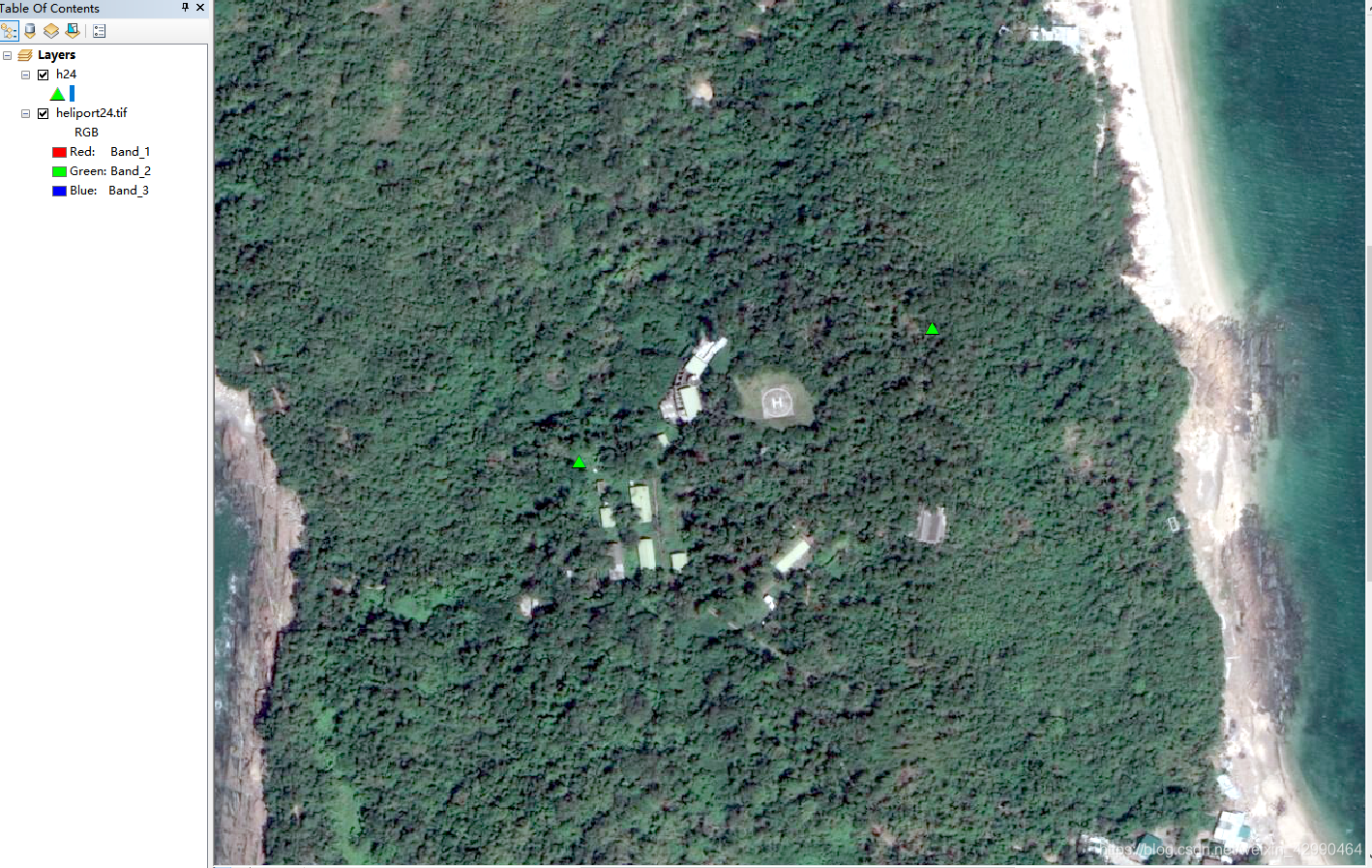
4. 效果预览